
ADVANCED GROUNDWATER MAPPING FOR GOVERNMENTS, INTERNATIONAL AGENCIES AND MAJOR COMPANIES
WATEX™ Groundwater Mapping
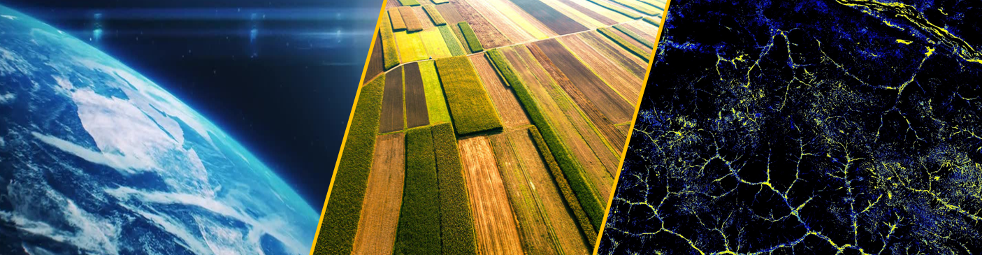
At Country or County scale, the WATEX™ Advanced Groundwater Mapping results reveal underground aquifers with their recharge and their associated potential agricultural land.
The results considerably reduce operational risks and secure investments for sustainable economic development, particularly for large-scale irrigated agriculture and bulk water supply development.
The WATEX™ results are central to carrying out technical and economic feasibility studies and bankable business plans determining the size of the required investment before engaging any field operations.
Home |
WATEX™ Solutions |
WATEX™ Groundwater Mapping
")
THE WATEX™ SYSTEM USED FOR IRRIGATED AGRICULTURE IN NIGER (2019-2021)
WATEX™ System: A game changing technology for irrigated agriculture in a national masterplan
More details
, Dr. Saud Amer (USGS) and Sharon Day (former US ambassador to Costa Rica) (© RTI, 2019)")
THE WATEX™ SYSTEM, AN INNOVATIVE TECHNOLOGY FOR NATURAL RESOURCES INVENTORY OF COSTA RICA (2018)
Use of the WATEX™ System in groundwater exploration and assessment in Costa Rica alongside the Ministry of Environment and Energy (MINAE) and the U.S. Geological Survey (USGS).
More details
")
THE WATEX™ GROUNDWATER MAPPING SOLUTION ENABLING THE DISCOVERY OF GIANT GROUNDWATER RESERVES IN KENYA (2013)
Giant shallow and deep groundwater reserves discovery in Turkana, Kenya, during a survey carried by RTI on behalf of UNESCO for the Government of Kenya.
More details
 is located in the eastern highlands of Ethiopia, close to the border of Somaliland, on the southern part of the Afar depression. (© RTI, 2013)")
GROUNDWATER EXPLORATION FOR AN INTERNATIONAL INSTITUTION IN ETHIOPIA (2013)
The WATEX™ System approach was used to achieve rapid, large-scale mapping of shallow and deep aquifers in the Ogaden area, Ethiopia. The validity of the model has been proven by 30 successful wells drilled by IRC.
More details
")
THE WATEX™ SYSTEM FOR POST-WAR RECONSTRUCTION IN IRAQ (2011-2018)
The central Government of Iraq - via the EU and the KRG - engaged RTI to make a national inventory of shallow and deep groundwater systems.
More details
")
THE WATEX™ SYSTEM, A SOLUTION TO FIND WATER FOR KAKUMA REFUGEE CAMP IN KENYA (2012)
WATEX™ System applied in Kakuma, one of the biggest refugee camp in Africa with over 200 000 displaced individuals.
More details
")
THE WATEX™ SYSTEM, A KEY TOOL FOR INTERNATIONAL AGENCIES TO FIND WATER FOR DARFUR REFUGEES IN SUDAN (2005-2008)
WATEX™ System applied in Darfur, leading to the drilling of 1800 wells since 2005 and contributing to the survival of 3 million internally displaced persons.
More details
")
THE WATEX™ SYSTEM, A GROUNDBREAKING TECHNOLOGY FOR INTERNATIONAL AGENCIES TO FIND WATER FOR DARFUR REFUGEES IN CHAD (2005-2008)
Mapping Groundwater Potential with the WATEX™ System to identify new refugee camps supporting 30,000 persons per unit.
More details
Contact Us
