Fire prevention and ecoforestry mapping Tanzania
Fire prevention and ecoforestry mapping Tanzania

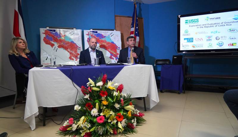
THE WATEX™ SYSTEM, AN INNOVATIVE TECHNOLOGY FOR NATURAL RESOURCES INVENTORY OF COSTA RICA (2018)
Use of the WATEX™ System in groundwater exploration and assessment in Costa Rica alongside the Ministry of E...
More details

EXPO AGUA - CHILE - 2022
Dr. Alain Gachet, special guest of the EXPO AGUA Congress in Santiago de Chile - October 13, 2022
More details

MCC-financed study finds Niger to be most groundwater-rich country in the Sahel region
RTI Exploration contributed to revolutionary groundwater discoveries in Southern Niger. March 22, 2023
More details

Lancement de l’étude sur la télédétection des ressources en eau
French article of the MCA-Niger about the launch of RTI study in Niger "Groundwater resources assessment" - April 2019
More details

Alain Gachet, creador de sistema para detectar agua subterránea por satélite
An article in Spanish, describing Alain Gachet's view about the climatic situation in Chile.
October 14, 2022
More details

L'homme qui fait jaillir l'eau du désert
Alain Gachet published his first book, "L'homme qui fait jaillir l'eau du désert" - 2015
More details
RTI EXPLORATION is a global leader in the exploration sciences. We provide clients with the expertise and technology they need to discover and develop critical resources, from minerals and metals to groundwater and energy resources. Our team of highly experienced professionals has a proven track record of success in locating and developing some of the world's most important resources. Areas of expertise:
Our technologies can be adopted independently or combined together into an integrated solution, ready for execution project development master plan:
- WATEX™ : Precise Delineation of Groundwater Reservoirs down to 3 Km
- BAMEX™ : Uncovering the Optimal Mineral Potential to be Unlocked
- HEXUB™ : Accurate Delineation of Areas of Major Hydrocarbon Interest
- OSIRIS™ : Environmental Monitoring, Soil and Forest Classifications
Our services in the sector of
Tanzania
Our area of activity for this service
Fire prevention and ecoforestry mapping
Contact Us


